ABSD unveils aerial bathymetric lidar surveying for offshore wind projects
- October 17, 2024
- 0
The Department of Energy (DOE) is on track to introduce the Green Energy Auction (GEA) for offshore wind capacities next year, giving developers an eight-month window to submit bids.
This forthcoming auction has prompted developers to prioritize establishing their projects, though they encounter significant challenges in determining seabed conditions.
Atty. Jose Layug Jr., a former Undersecretary at the DOE, highlighted the importance of the Marine Spatial Plan in this context, as it pinpoints regions deemed unsuitable for offshore wind development, thereby streamlining project planning and implementation.

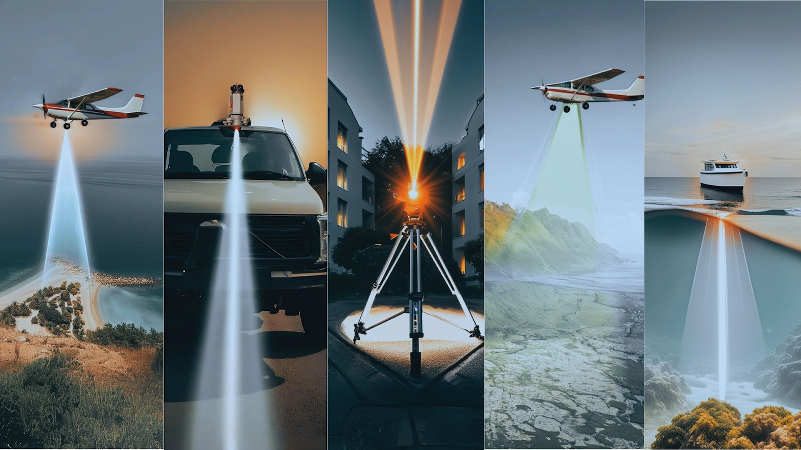
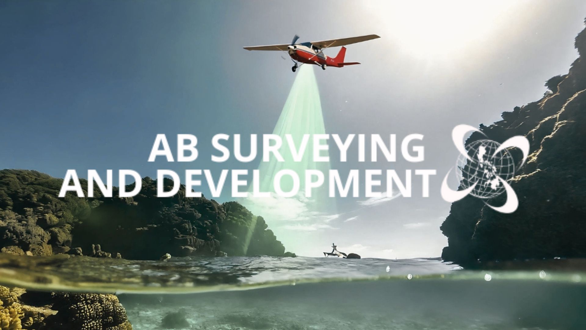
AB Surveying and Development (ABSD), a trusted partner for renewable energy firms, has brought the Riegl VQ-840-G to the Philippines, an advanced Aerial Bathymetric LiDAR system
The Riegl VQ-840-G is mounted on a Cessna aircraft and uses a green laser capable of penetrating water. This innovative technology is particularly beneficial for RE firms, especially those involved in offshore wind projects.
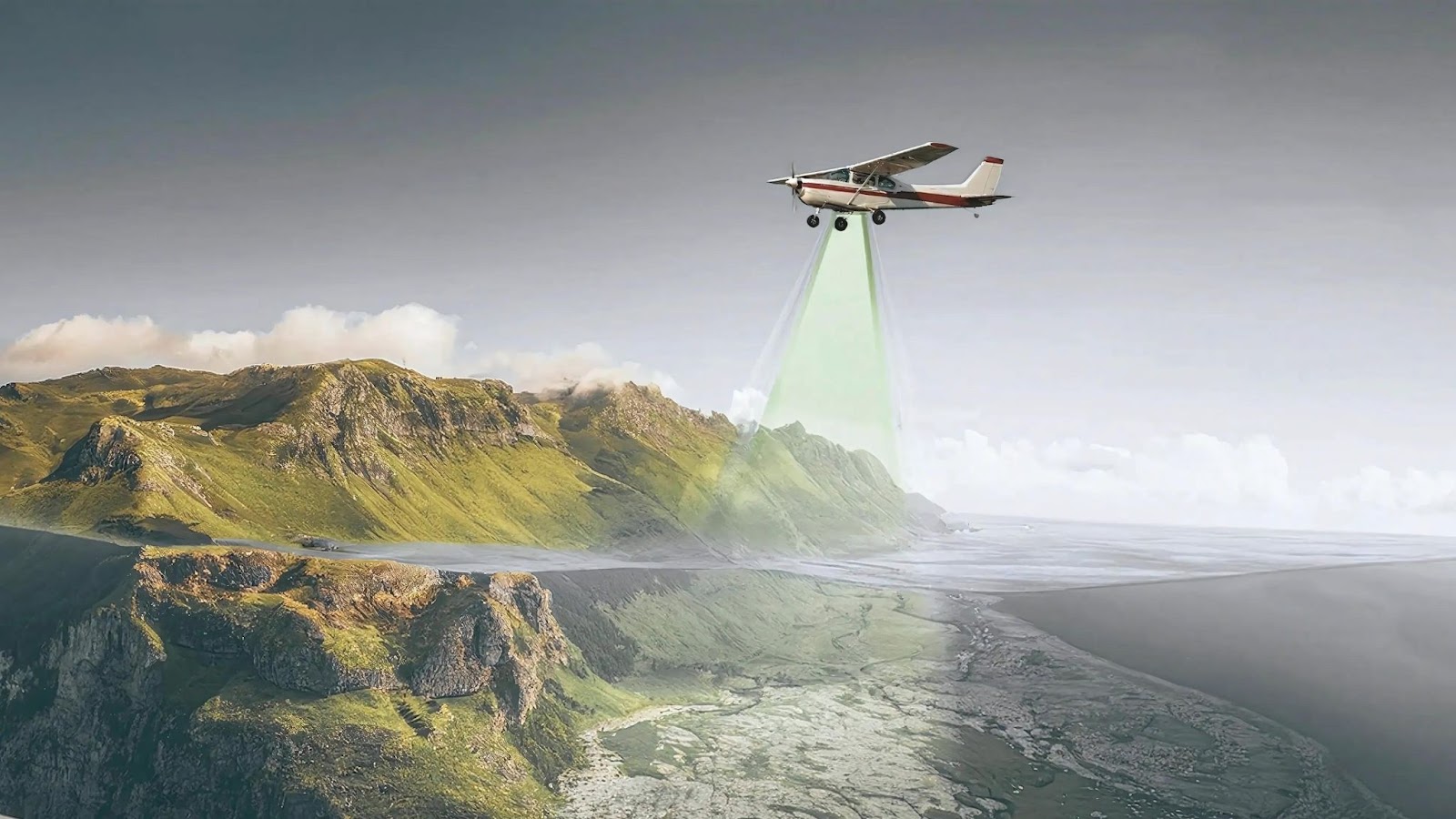
The Aerial Bathymetric LiDAR system can cover an area of 20 kilometers in just two minutes, which takes one to two hours with traditional boat-based methods for the same distance. Additionally, boat surveys often face interruptions due to rough sea conditions, while aerial surveys can continue uninterrupted.
According to ABSD founder and general manager, Engr. Antonio “Tony” Botor, speed is a crucial advantage of Aerial Bathymetric LiDAR Surveying, particularly for offshore wind projects.
“With considerably faster acquisition speed versus other surveying options, aerial bathymetric LiDAR can secure data at a pace that immediately translates to a quick turnaround time for the delivery of the bathymetric map, allowing firms to design and plan efficiently,” said Engr. Botor.
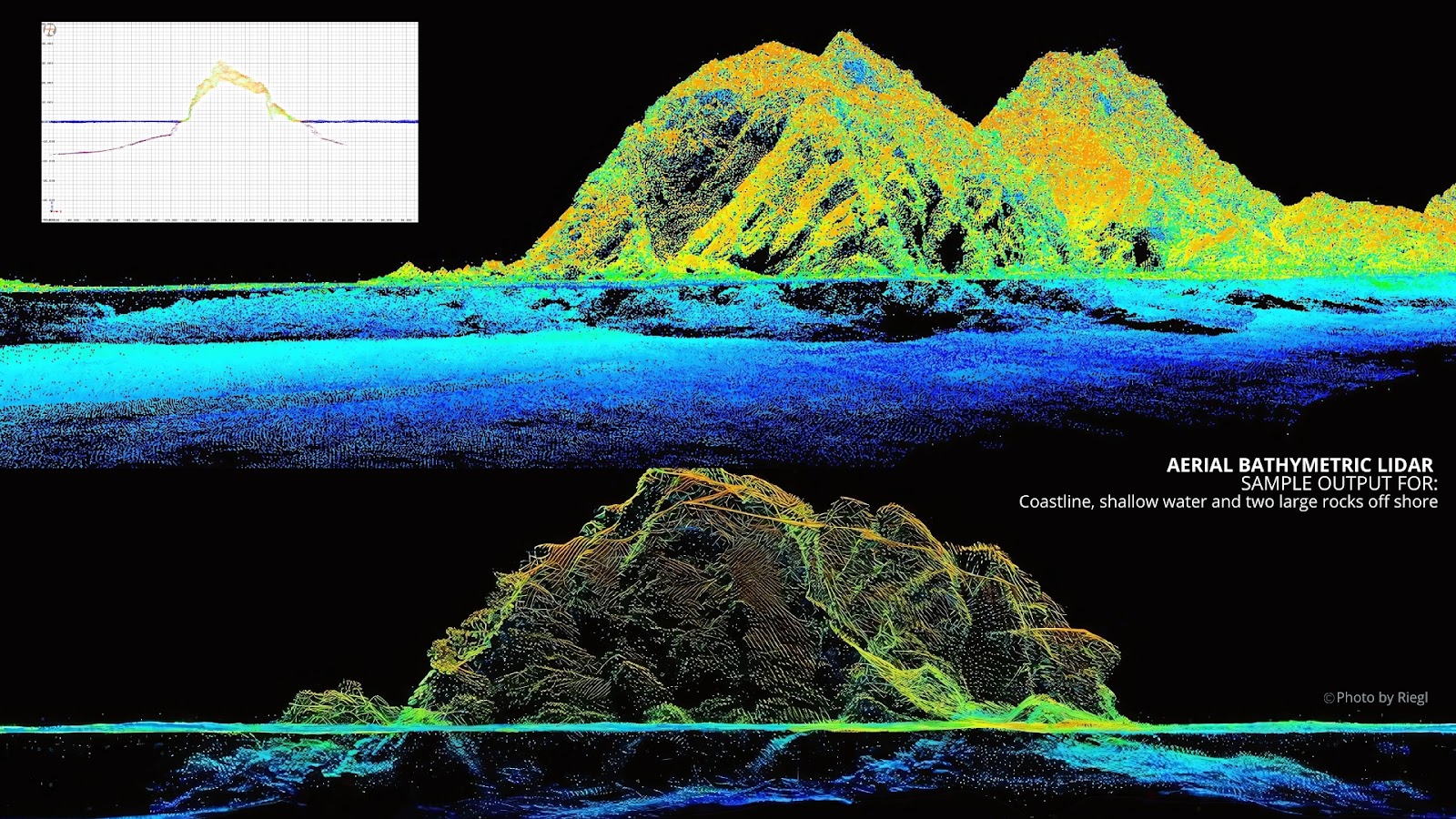
Aerial Bathymetric LiDAR can also provide a comprehensive 3D model of the seabed, eliminating the need for random site checks, as developers can visualize the underwater terrain with precision. It offers a safer and faster alternative for developers who prefer to build in shallow waters, with depths ranging up to 30 meters, depending on the water’s clarity.
Given the vast coastlines of the Philippines, accurate underwater surveys are essential for determining safe docking locations and understanding the depth variations near shorelines, making it crucial for offshore wind projects, and port and pier developers.
This technology was first developed in 2019, making it a relatively new but essential tool for modern surveying.
“Our clients from the renewable energy industry are almost always in a race against time. Our services offer this solution: an expedited establishment of their projects, quicker implementation, and a more timely contribution to renewable energy initiatives,” he added.
When asked why ABSD adopted this technology, Engr. Botor explained that the firm sought a faster and more efficient way to gather accurate data underwater. The introduction of Aerial Bathymetric LiDAR filled this gap, pr
ABSD’s portfolio showcases its comprehensive expertise in surveying solutions tailored to the energy industry, including for the power and energy sectors. This includes Aerial LiDAR Surveying for precise mapping and infrastructure planning in onshore renewable projects. For offshore projects, ABSD uses Aerial Bathymetric LiDAR for shallow waters and Multibeam Echosounder (MBES) for deep-water mapping, ensuring detailed underwater surveys. They also offer mobile and terrestrial LiDAR services, catering to different surveying needs.