ABSD offers breakthrough solution to boost offshore wind efficiency
- September 30, 2024
- 0
With the Department of Energy (DOE) gearing up to launch the green energy auction (GEA) for offshore wind next year, developers are racing to kickstart their projects, creating a competitive landscape.
Surveying these areas, particularly underwater, presents unique challenges compared to land-based projects. Murky waters, deep ocean levels, and concerns over marine mammal safety are just a few of the obstacles that firms must overcome.
However, a solution that addresses both the precision and speed required for offshore wind projects while ensuring that marine ecosystems remain undisturbed is on the horizon.

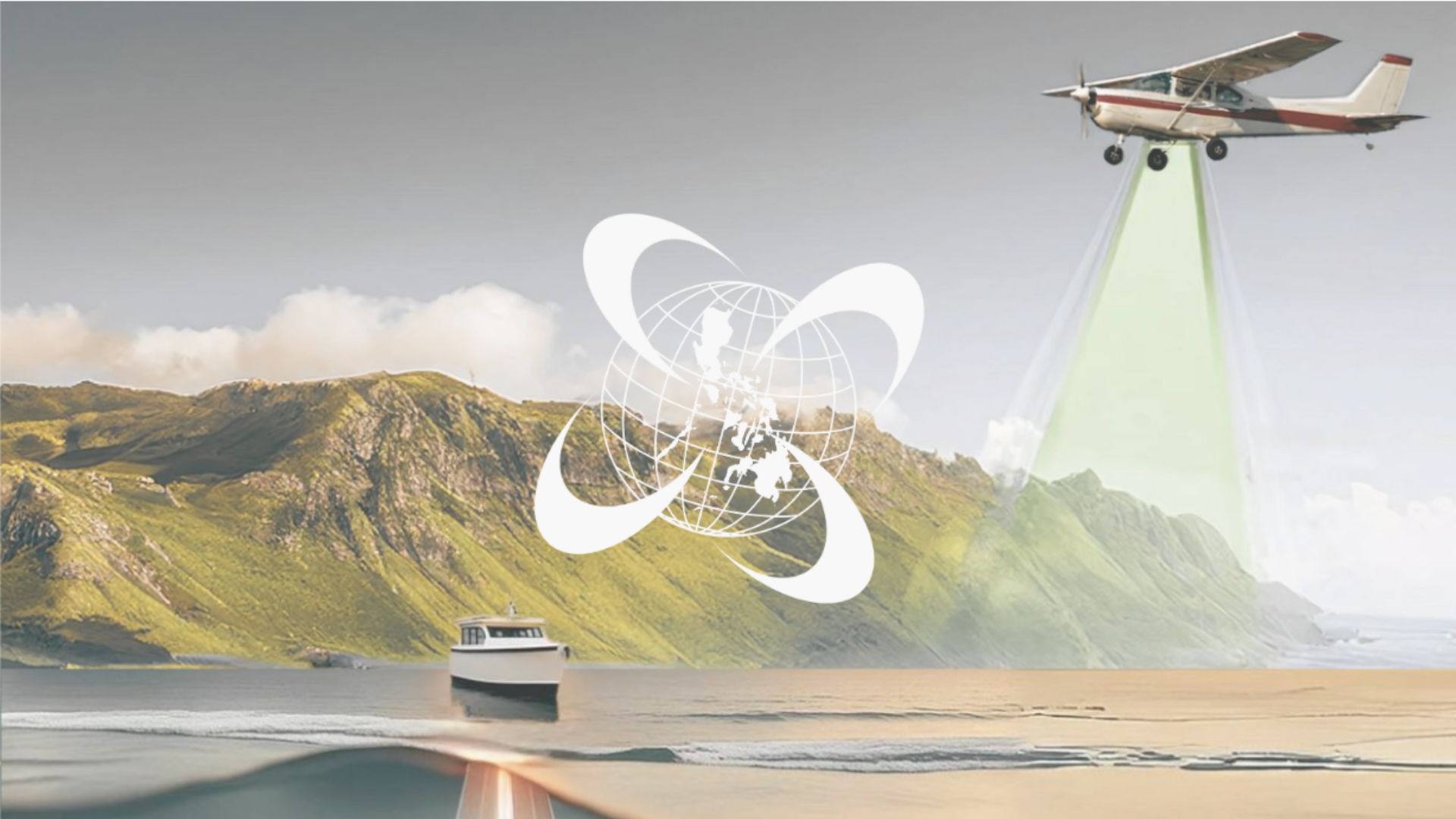
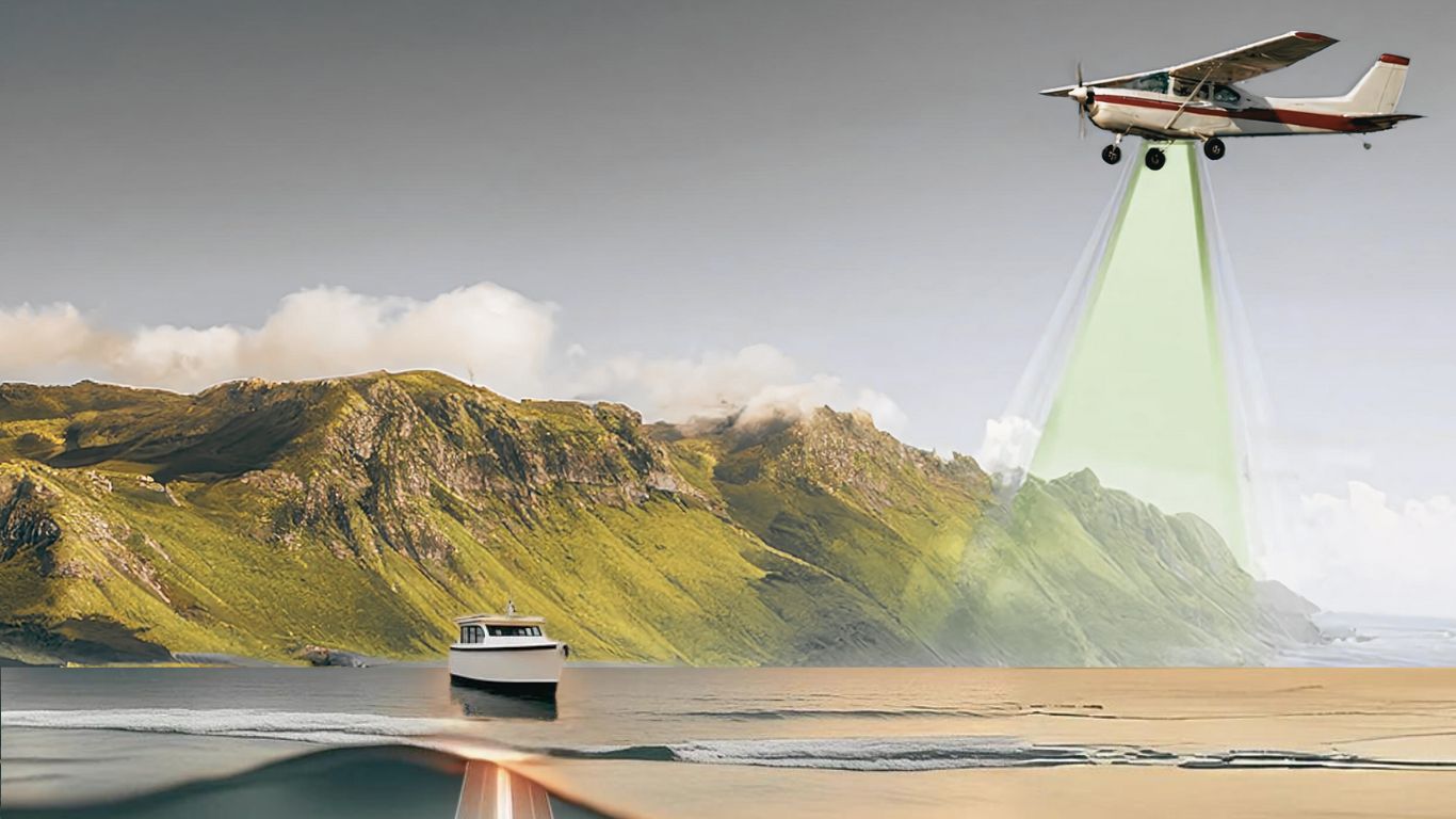
AB Surveying & Development (ABSD) introduces Aerial Bathymetric LiDAR Surveying, a method wherein a Light Detection and Ranging (LiDAR) equipment is mounted on an aircraft and uses green lasers to penetrate water and collect data from the seabed – which was not possible before.

“It’s designed to penetrate water para makuha yung data sa ilalim. Usually, isa sa challenges ng LiDAR is water talaga,” explained ABSD founder and general manager, Engr. Antonio “Tony” Botor.
Red lasers (which are typically used in Aerial LiDARs), in contrast, can’t penetrate water as they absorb or reflect red light, preventing it from going deeper.
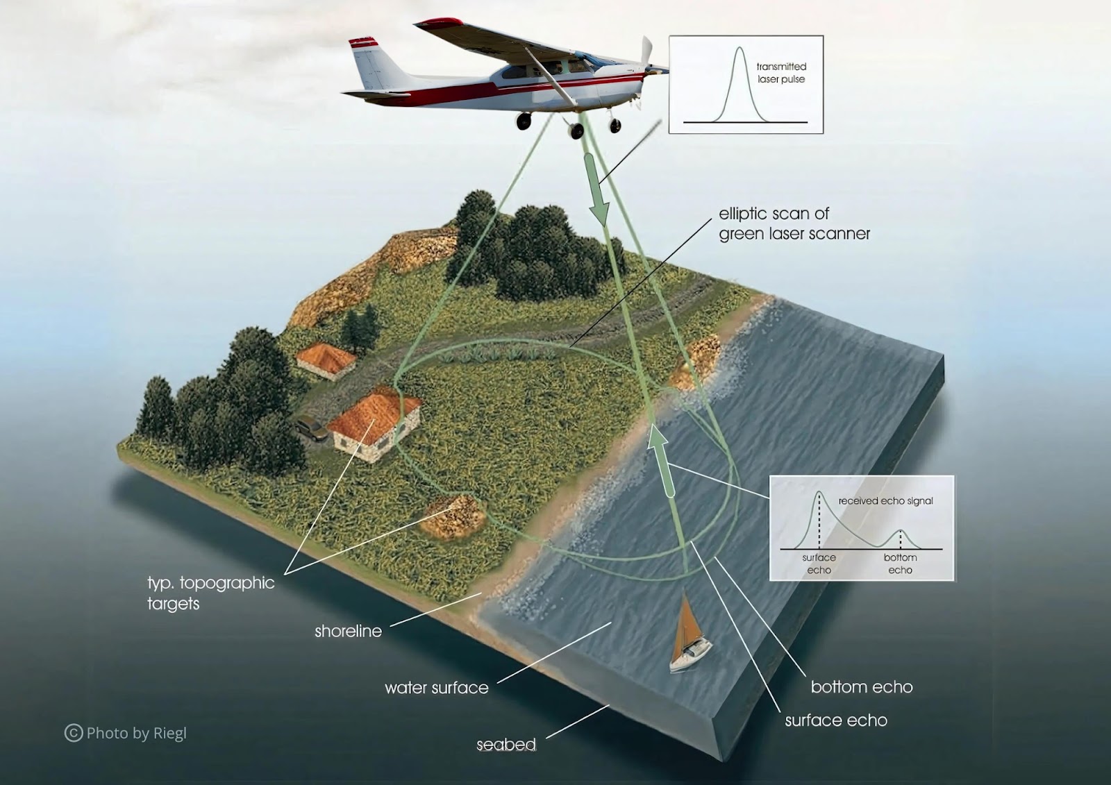
Aerial LiDAR surveys typically involve using aircraft to scan terrains from overhead. Similarly, Aerial Bathymetric LiDAR uses an aircraft to collect seabed data, especially in shallow waters. This method offers a faster, non-intrusive way to survey offshore sites compared to traditional methods.
While Aerial Bathymetric LiDAR excels in shallow waters, ABSD also uses Multibeam Echosounder (MBES) for deeper areas. MBES is mounted on vessels around 15 meters in length, which allows easier navigation and maneuverability at sea compared to larger boats. Each of these methods has its strengths, but rather than competing, they complement each other.
Engr. Botor highlighted that shallow waters, typically up to 2.5m Secchi depth or 25m depending on the clarity of the water, are best suited for Aerial Bathymetric LiDAR. Meanwhile, MBES is more effective for deeper water surveys.
“Some offshore wind developers, mas pini-prefer nila yung shallow water like 4 to 10 meters lang ang depth. While other developers, mas gusto nila yung malalalim. Sa bathymetric survey, the problem is pag yung developer gusto niya sa shallow water, nahihirapan yung multibeam na mag-survey doon kasi very challenging yun lalo na sa boat,” explained Engr. Botor. He added that sonar’s swath increases with depth, making it less efficient for shallow waters and that vessels are at risk of running aground on the seabed.
In offshore wind projects, speed and coverage are critical factors. Aerial Bathymetric LiDAR offers a significant advantage by covering vast areas in a fraction of the time, with planes being able to survey 20 kilometers in just 2 minutes. This is particularly useful for initial assessments.
On the other hand, Multibeam Echo Sounder (MBES) is used for detailed surveys in deeper waters, where it excels despite taking more time and being affected by rough seas. Each method plays a vital role depending on the specific requirements of the survey.
ABSD is further advancing its capabilities with the introduction of the Riegl VQ-840-G, the first Aerial Bathymetric LiDAR technology in Southeast Asia.
The Riegl VQ-840-G can reach depths of up to 25 meters, making it ideal for offshore wind developers working in shallow waters. For deeper surveys, beyond 30 meters, MBES remains the preferred option.
This technology is not limited to offshore wind projects but also for port developers and government agencies needing detailed seabed data. Engr. Botor emphasized the importance of this equipment, particularly in shallow waters, where traditional methods face challenges like equipment damage or disruption to marine life.
Aerial Bathymetric LiDAR is also crucial for projects involving submarine transmission lines. Firms must assess underwater conditions to safely plan cable routes.
“So with this aerial bathy lidar, we are able to connect the data ng land as well as yung malalalim na water. So parang ito yung naging bridge namin para at least seamless yung data from land to shallow and deep waters natin. It would be easier for consultants or clients to really analyze and study yung topography from land to underwater,” added ABSD.
Through these innovations, ABSD continues to lead the way in offshore wind and renewable energy development, making Aerial Bathymetric LiDAR a vital tool for fast, accurate, and environmentally safe surveys.