How LiDAR surveying can change the game in energy
- September 16, 2024
- 0
With the rise of renewable energy projects in the country, selecting the most effective surveying methods is crucial for timely project initiation.
Aside from conventional surveying, photogrammetry was once a widely used surveying method that involved capturing photographs from various angles and processing them with specialized software to create maps and 3D models.
Photogrammetry, while useful

In a race against time to provide ample supply of power to a growing nation, LiDAR (Light Detection and Ranging) surveying is seen as an indispensable step in renewable energy initiatives—offering the accuracy and speed that modern projects demand.
“Ang nangyayari kasi sa photogrammetry, nagme-merge ng mga overlapping photos. From there, makakagawa ka ng 3-dimensional object. Around 30 to 40 years ago, wala pang LiDAR Surveying, so kapag kailangan na ang project, imbes na gumamit ng conventional survey methods—which would take years—they would settle for photogrammetry. Sinasabi nila, ‘Pwede ba kahit estimate na lang, basta ma-deliver mo in 2 to 3 months,'” explained ABSD founder and general manager, Engr. Antonio “Tony” Botor.
Today, modern advancements have introduced a more efficient approach through LiDAR surveying.
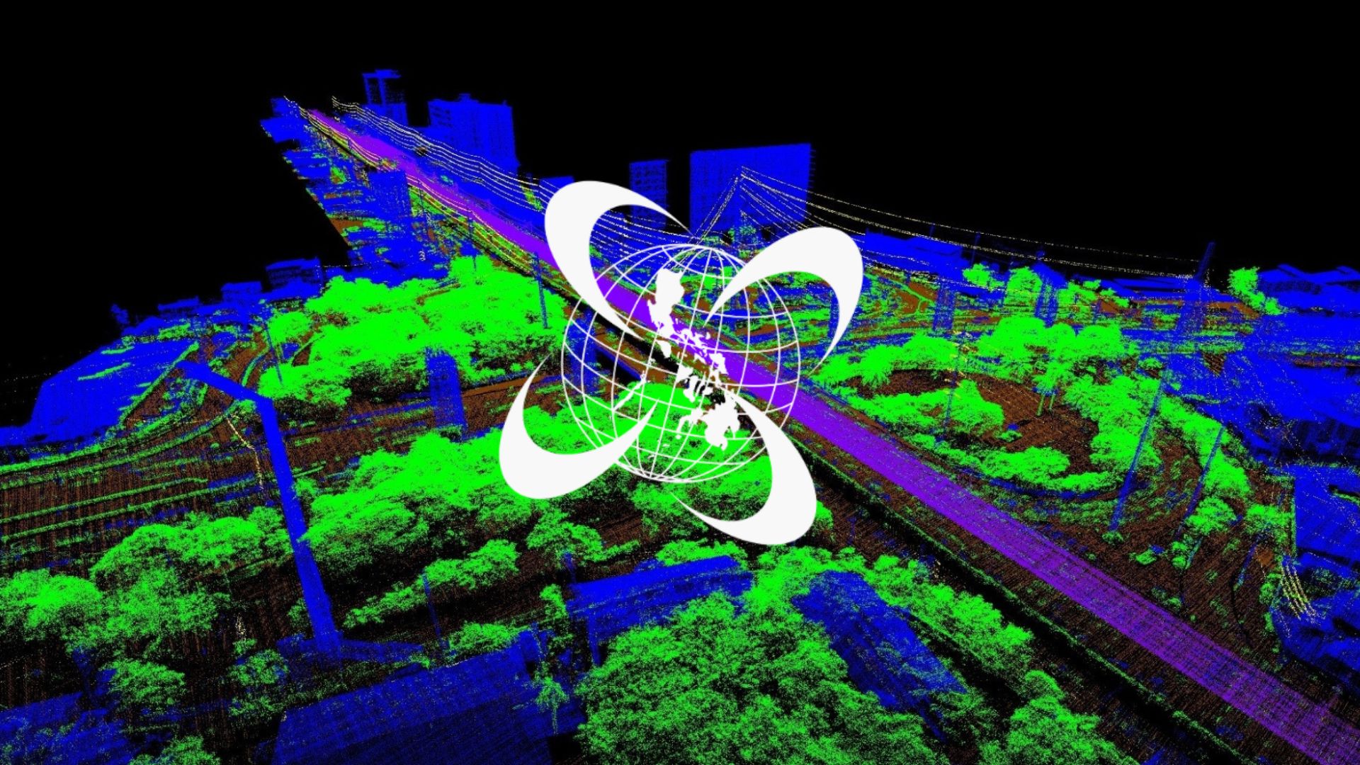
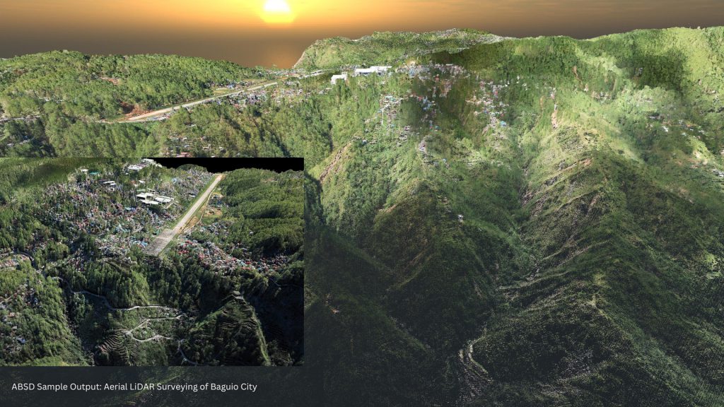
LiDAR utilizes infrared lasers to measure distances, surveying a 1,000-hectare area in just four hours, delivering results in 1 to 2 months, providing significant cost savings and competitive advantages for energy companies.
“With the Philippines’ push for massive renewables – including large-scale offshore wind and floating solar projects – this supply-shortage scenario can be prevented by adopting more coordinated planning between generation and transmission,” said former DOE Undersecretary Atty. Jay Layug.
In the Philippines, AB Surveying and Development is the only LiDAR surveying firm that uses a manned aircraft, allowing the scanning of larger areas across vast lands and sea areas. This enables renewable energy developers to accelerate their initiatives with fast and precise surveys.
“Kailangan kasi bigyan ng importance ang survey para yung magiging output o plano, lalo na sa mga renewable energy companies, ay tama ang kalalabasan. Pagdating sa budgeting nila, pag tama lahat ng naka-plan, walang mga overrun cost during the construction,” added Engr. Tony Botor.
LiDAR is seen as a game changer in the energy industry due to its capability of rapidly collecting data needed to develop a project.

MERALCO PowerGen is one firm that benefited from the speed and accuracy of LiDAR surveying.
After facing issues with conventional surveying methods for over two years, particularly with frequent errors during ground validation, the firm decided to switch to LiDAR surveying and was able to resolve the issues and deliver a precis
ABSD emphasized that even minute details, such as vegetation in land surveying, are crucial and should not be overlooked, as they can impact the overall design and potentially hinder the progress of the entire project.
Conventional surveying methods often miss vegetated areas, resulting in incomplete data since capturing accurate information in such areas can be challenging.
A faster surveying method can help resolve bottlenecks in energy projects, including financial losses due to manpower and extended survey hours to ensure accuracy.
“Since more on computerized ito, wala nang masyadong interference from human computations, human manipulation ng equipment…. Mas accurate talaga and mas reliable ang LIDAR,” added Engr. Botor.
LiDAR can help firms secure precise coverage of their entire project area and improve timelines due to rapid map production.
According to Power and Energy Solutions, LiDAR technology can be utilized throughout an energy project, from research and development to post-construction operations and monitoring. Thanks to advancements in this technology, LiDAR can be applied to wind energy projects worldwide.
LiDAR stands out for its reliability, providing accuracy, range, and depth of data. As wind turbines grow larger and terrains become more complex, LiDAR’s advancements make it the industry standard for precise measurements.
As pioneers in LiDAR Surveying in the Philippines, AB Surveying & Development is at the forefront of surveying technology and can transform your energy projects into functioning realities.