LiDAR surveying a must in RE—ABSD
- August 28, 2024
- 0
Area surveying is a critical step in ensuring the successful development of renewable energy projects. This enables developers to assess the land’s condition and map out the entire project workflow — from the initial construction to full operation.
With the growing demand for renewable energy, there is a pressing need to adopt more efficient and accurate surveying methods.
AB Surveying & Development (ABSD) has provided power firms with a range of advanced Light Detection and Ranging (LiDAR) surveying services that highly reduce the time required for land and marine assessments.

Surveying is more than an initial preparation; it is a critical phase that will impact the project’s full course. Without proper surveying, projects face cost delays and errors during construction, which might undermine the project’s success.
As the pioneering firm in the Philippines to offer LiDAR services, ABSD is at the forefront of accurate surveying technology, catering specifically to the needs of the renewable energy sector.
Traditional land surveying methods, which require various teams to measure distances, elevations, and angles manually, are time-consuming.
Surveying potential areas for RE projects can take two to three years to complete. This rigorous process can delay the development of projects, which could compromise the validity and accuracy of the survey data and actual site conditions.
ABSD revolutionizes this process through LiDAR technology, which offers unparalleled speed and accuracy– a must for the surveying needs of the RE sector.
LiDAR uses an infrared laser to rapidly measure the topography of a project site. This technology enables energy firms to assess the feasibility of land for RE projects, identify flat or sloping areas, and determine potential environmental impacts—while minimizing the need to go onsite.
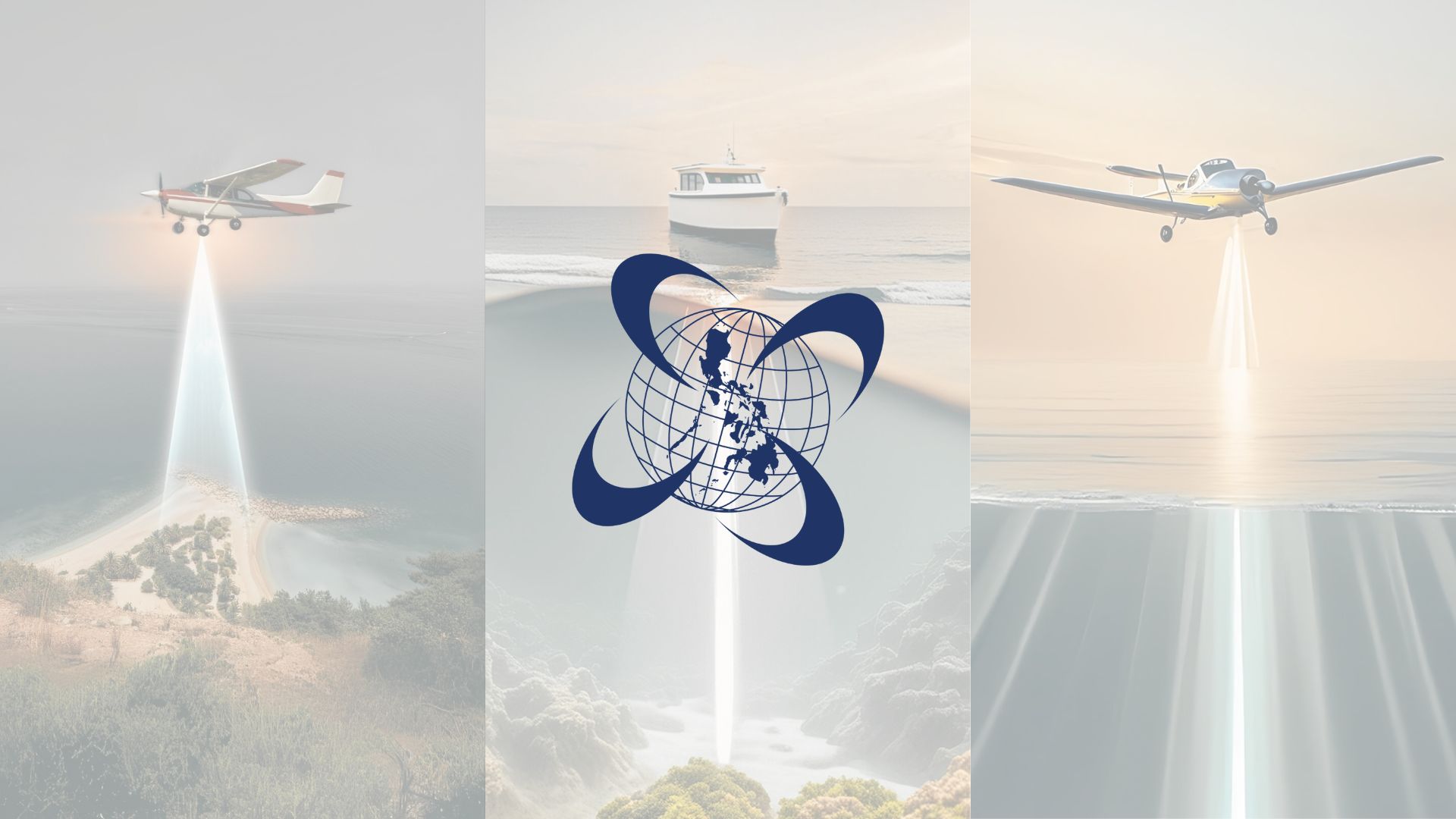
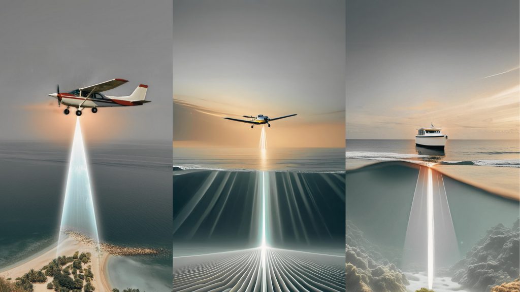
As opposed to traditional surveying methods, ABSD’s Aerial LiDAR surveys can cover 1,000 hectares in just four hours. The firm’s Aerial LiDAR surveys use specialized aircraft, such as the fuel-efficient Cessna 172K, piloted by in-house experts to ensure maximum efficiency and safety.
This method not only speeds up the surveying process but also offers a level of confidentiality that traditional methods cannot. “All people will really see is a plane flying overhead,” minimizing the risk of project details being disclosed prematurely.
Meanwhile, for projects that require underwater surveying, such as offshore wind farms, ABSD offers two types of Bathymetric or Hydrographic surveying – Aerial Bathymetric LiDAR for shallow waters and Bathymetric surveying using multibeam echosounder for deep waters.
Traditional methods of underwater surveying can take days due to travel and setup time, on top of mounting the equipment on a boat which makes data acquisition longer.
However, opting for Aerial Bathymetric LiDAR surveying, which uses lasers designed to penetrate water and is mounted on a plane, allows for rapid data collection.
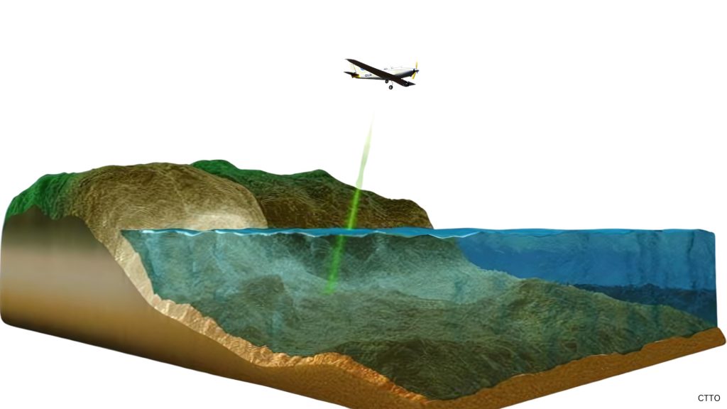
This technology is crucial for assessing underwater soil conditions and determining the feasibility of offshore projects. Aerial Bathymetric LiDAR can survey up to 25 meters deep, depending on water clarity, and ABSD uses tools like the Secchi disk to ensure optimal conditions for data collection.
“The Secchi disk would be submerged underwater until they are no longer visible. For example, if the water is murky, they might disappear from view after just one meter. But if the water is clear, you might still see it up to 10 meters deep. Now, when you use Bathymetric LiDAR to measure the sea, it will show 2.5 times the depth that you could see,” said ABSD Sales Unit Manager Engr. James Bryan Botor.
Additionally, ABSD’s terrestrial LiDAR services are ideal for surveying old structures slated for renovation or reconstruction.
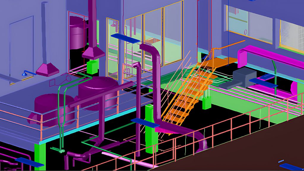
This technology creates detailed 3D models of existing buildings, ensuring that any restoration work is based on accurate and comprehensive data.
“The purpose of this is to make sure that if there’s something happening to the structures, the old ones can be reconstructed because there’s a 3D model,” said ABSD founder and general manager, Engr. Antonio “Tony” Botor.
Furthermore, ABSD offers mobile LiDAR surveying, utilizing the VMZ-2000 LiDAR scanner. This service is particularly useful for road surveys, providing precise and efficient data collection for infrastructure projects.
When asked which LiDAR is the top choice among energy firms, ABSD explained that Aerial LiDAR dominates land-based projects, while Aerial Bathymetric LiDAR and Bathymetric Surveying using MBES (Multibeam Echosounder) are preferred for offshore endeavors.
“The aerial LiDAR is the fastest in both acquisition and processing time. That is why we believe that for renewable energies, at least for land-based, the aerial LiDAR is the top choice. For offshore projects, it’s a mixture of Bathymetric LiDAR and Bathymetric Surveying using MBES (Multibeam Echosounder),” said Engr. James Botor.
Furthermore, the surveying firm also offers Seabat Multibeam Echo Sounder (MBES), which is utilized for depths beyond the reach of Aerial Bathymetric LiDAR. If an energy firm requires deeper water penetration, the MBES enables ABSD to collect seamless data from land to the deepest waters possible.

ABSD boasts an impressive portfolio of clients from the renewable energy sector, including industry leaders like VENA Energy, AC Energy, First Gen, and Blueleaf Energy, among others.
ABSD’s LiDAR services—spanning aerial, bathymetric, terrestrial, and mobile applications—are transforming the landscape of renewable energy project development. By reducing surveying times from years to mere hours, ABSD guarantees that energy firms can now fast-track their projects and bring them to life at extraordinary speeds.
By adopting LiDAR as the go-to method for all types of surveying, energy firms are assured that their projects are developed efficiently and accurately, in line with the latest technological advancements, and can even compete with firms on a global scale.
Elevate your surveying experience with AB Surveying & Development – where LiDAR sets the standard for success.